1
/
of
1
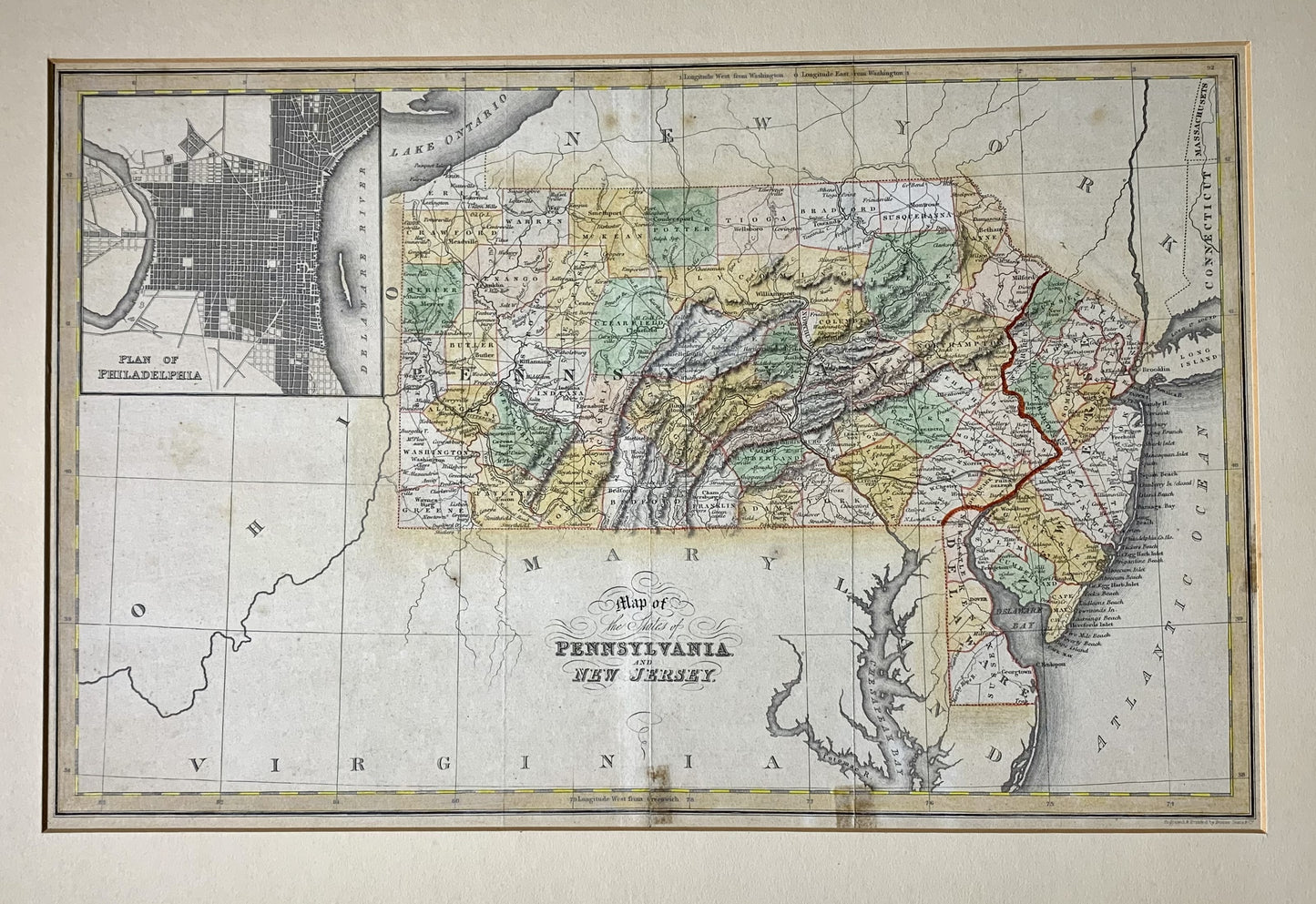
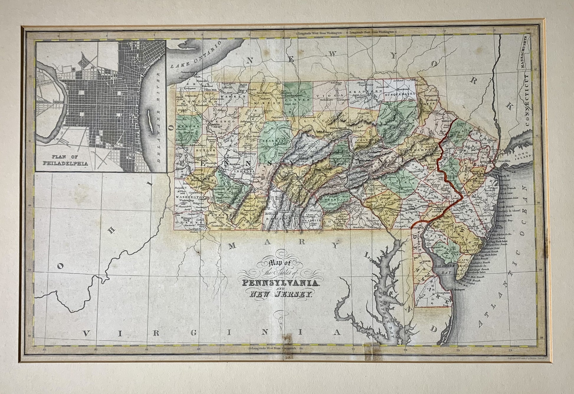
Map of Pennsylvania and New Jersey 1832
Map of Pennsylvania and New Jersey 1832
Regular price
$175.00
Regular price
Sale price
$175.00
Unit price
/
per
Couldn't load pickup availability
(with) Plan of Philadelphia. London, published March 15, 1832 by I.T. Hinton & Simpkin & Marshall. Engraved & printed by Fenner Sears & Co. Published in An atlas of the United States of North America, corrected to the present period, accompanied by a condensed view of the history & geography of each state compiled from the latest official documents, London, Simpkin & Marshall -- and Thomas Wardle, Philadelphia. 1832. Hand colored engraved map, relief shown by hachures, prime meridians: Washington and Greenwich. "92", map also covers Delaware.
15.5 x 9 7/8